364-B NEPONSET ST
Owner Information
BROWN SEBASTIAN
364-B NEPONSET ST
CANTON, MA 02021


Property Details
364-B NEPONSET ST is classified as a Residential Condominium (Condo).
The primary structure on this property was built in 1984. There are 862ft2 of built area within this property. There is 862ft2 of residential/living space within this property. This property is listed as having 5 rooms.
364-B NEPONSET ST is valued at $239,500. The land is valued at $0 and the structures are valued at $239,500.
This property is in Zone GR. Confirm with local Zoning Board authorities to ensure there are no overlays or other easements on this property.
The most recent deed for 364-B NEPONSET ST is recorded at the local registrar in Book 27652, Page 170. 364-B NEPONSET ST was last sold on Thursday, May 6, 2010 for $194,500.
Assessment data from fiscal year 2022.
Flood Data
According to the FEMA National Flood Hazard Layer, this property does not appear to be in a flood zone. It may also be in an area not yet reviewed. Nonetheless, confirm this information prior to taking any action.
To view the flood hazards around this property, create a FEMA "Firmette" Map of the area around 364-B NEPONSET ST.
Broadband Internet Providers
| Provider | Type | Bandwidth (mbps) | |
|---|---|---|---|
| GCI Communication Corp. | Satellite | 0 | 0 |
| Crown Castle Fiber | Fiber | 0 | 0 |
| Viasat Inc | Satellite | 100 | 3 |
| Verizon New England Inc. | DSL | 15 | 1 |
| Verizon New England Inc. | Fiber | 940 | 880 |
| Comcast | Cable | 1000 | 35 |
| VSAT Systems, LLC. | Satellite | 2 | 1 |
| HughesNet | Satellite | 25 | 3 |
Broadband service provider data from December 2020.
Adjacent Properties
- 394 NEPONSET ST
Mixed Use (Primarily Residential, some Commercial) owned by MASCIARELLI, DAVID M L/E - 360-711 NEPONSET ST
Residential Condominium owned by YANG CHUN - 360-712 NEPONSET ST
Residential Condominium owned by ABI-ESBER, NICOLE - 360-501 NEPONSET ST
Residential Condominium owned by COVITZ JAY A - 360-502 NEPONSET ST
Residential Condominium owned by ZAWATSKI, MATTHEW P & MCCUE, - 360-503 NEPONSET ST
Residential Condominium owned by WANG MU - 360-504 NEPONSET ST
Residential Condominium owned by POWERS PHILIP J & POWERS- - 360-601 NEPONSET ST
Residential Condominium owned by RETTMAN KEVIN D - 360-602 NEPONSET ST
Residential Condominium owned by FITZGERALD JILLIAN - 360-701 NEPONSET ST
Residential Condominium owned by PASTERIS JESSICA L - 360-702 NEPONSET ST
Residential Condominium owned by YUTZY, PATRICIA - 360-703 NEPONSET ST
Residential Condominium owned by MCKENNA, LISA - 360-704 NEPONSET ST
Residential Condominium owned by BOEY, PENG L & WONG, SARAH S - 360-505 NEPONSET ST
Residential Condominium owned by REDDICK ANGELA - 360-506 NEPONSET ST
Residential Condominium owned by MELANSON, GREGORY A & CARVALHO - 360-507 NEPONSET ST
Residential Condominium owned by SYNEYKO, OKSANA & IVAN - 360-508 NEPONSET ST
Residential Condominium owned by WALSH CAROL A - 360-603 NEPONSET ST
Residential Condominium owned by PHAM THUHA - 360-604 NEPONSET ST
Residential Condominium owned by GROUT, SILVIA & NICKOLAS - 360-706 NEPONSET ST
Residential Condominium owned by VAZQUEZ EFRAIN - 360-707 NEPONSET ST
Residential Condominium owned by PORRO RICHARD A JR - 360-708 NEPONSET ST
Residential Condominium owned by LIOUSAS EMMANUEL - 360-509 NEPONSET ST
Residential Condominium owned by AVANESYAN, ANAHIT - 360-510 NEPONSET ST
Residential Condominium owned by DAVE, SHAN M - 360-511 NEPONSET ST
Residential Condominium owned by FOLEY KERRY A - 360-512 NEPONSET ST
Residential Condominium owned by SAENA NINA PERCUKA AND JURI - 360-605 NEPONSET ST
Residential Condominium owned by DAHER GEORGE AND KARA - 360-606 NEPONSET ST
Residential Condominium owned by YI, TONY Z & CHAO-YI, KIMBERLY - 360-709 NEPONSET ST
Residential Condominium owned by AKAM LLC - 360-710 NEPONSET ST
Residential Condominium owned by YI TONY - 360 NEPONSET ST
Comm. Of Mass. (Other) owned by CANTON CROSSING CONDOMINIUMS - 360-705 NEPONSET ST
Residential Condominium owned by LEE PAUL B & TERESA M - 344 NEPONSET ST
Apartments with Four to Eight Units owned by NORTH HIGH REALTY CME LLC - 59-101 WALPOLE ST
Residential Condominium owned by BRIAN & PATRICIA MCARDLE - 59-103 WALPOLE ST
Residential Condominium owned by HOLTZMAN BRYAN A - 59-104 WALPOLE ST
Residential Condominium owned by BARLOW, ERIC A & CHAFFEE, - 59-105 WALPOLE ST
Residential Condominium owned by RIZZO, ALPHONSE - 59-106 WALPOLE ST
Residential Condominium owned by MILMAN, MELINDA M - 59-107 WALPOLE ST
Residential Condominium owned by WITCHER, PAMELA M - 59-306 WALPOLE ST
Residential Condominium owned by KANG, ZHI M & WU, YI - 59-307 WALPOLE ST
Residential Condominium owned by FLEMING DENISE - 59-308 WALPOLE ST
Residential Condominium owned by BARTHEL, JAMES M & LORETTA A - 59-309 WALPOLE ST
Residential Condominium owned by WANG, CHEN - 59-310 WALPOLE ST
Residential Condominium owned by DRURY STEVEN J AND KALLIONTZI - 59-311 WALPOLE ST
Residential Condominium owned by MASSIH, DALE - 59-313 WALPOLE ST
Residential Condominium owned by LOH, HOWARD J - 59-314 WALPOLE ST
Residential Condominium owned by CAVALLARO, CHRISTOPHER C - 59-108 WALPOLE ST
Residential Condominium owned by OAKTREE PROPERTIES LLC - 59-109 WALPOLE ST
Residential Condominium owned by HELLMUTH, FRANK E & LYNN D - 59-110 WALPOLE ST
Residential Condominium owned by SMOLLER, RACHEL B - 59-111 WALPOLE ST
Residential Condominium owned by NEE WILLIAM J AND WENDY A - 59-112 WALPOLE ST
Residential Condominium owned by HILDA R FERRIS IRREVOCABLE TR - 59-113 WALPOLE ST
Residential Condominium owned by DIANE T SPARROW TRUST OF - 59-115 WALPOLE ST
Residential Condominium owned by KOZAK, PAMELA - 59-116 WALPOLE ST
Residential Condominium owned by JD REALTY TRUST - 59-117 WALPOLE ST
Residential Condominium owned by MARGARET E MEISSNER IRREV TR - 59-118 WALPOLE ST
Residential Condominium owned by SAROUFIM, TONY - 59-119 WALPOLE ST
Residential Condominium owned by PTASHNICK PAUL L AND ROJAS ANA - 59-120 WALPOLE ST
Residential Condominium owned by 59-120 WALPOLE STREET REALTY L - 59-121 WALPOLE ST
Residential Condominium owned by FAY S CROSSLEY REVOCABLE TRUST - 59-123 WALPOLE ST
Residential Condominium owned by CATARINA R BISCAIA REVOCABLE - 59-201 WALPOLE ST
Residential Condominium owned by 59 WALPOLE STREET LLC - 59-202 WALPOLE ST
Residential Condominium owned by MARION P BENDER REVOCABLE TR - 59-203 WALPOLE ST
Residential Condominium owned by LEONIE SHAPIRO TRUST - 59-205 WALPOLE ST
Residential Condominium owned by WALSH, CAROL - 59 WALPOLE ST
Comm. Of Mass. (Other) owned by RIVER VILLAGE CONDOMINIUM - 59-206 WALPOLE ST
Residential Condominium owned by SLOTNICK ELYSE - 59-207 WALPOLE ST
Residential Condominium owned by MURPHY PHILIP A AND LORRAINE P - 59-208 WALPOLE ST
Residential Condominium owned by ABBER ROBIN C - 59-209 WALPOLE ST
Residential Condominium owned by LIANG MEGHAN - 59-210 WALPOLE ST
Residential Condominium owned by SHIRLEY C. DONEHEY FAMILY IRR. - 59-211 WALPOLE ST
Residential Condominium owned by MARIA TIGOU BOCK LIVING TRUST - 59-212 WALPOLE ST
Residential Condominium owned by 59-120 WALPOLE STREET REALTY L - 59-214 WALPOLE ST
Residential Condominium owned by LAKRITZ JON W AND JANE S - 59-215 WALPOLE ST
Residential Condominium owned by KOLINCHAK, OLIA - 59-216 WALPOLE ST
Residential Condominium owned by DUFAULT, CLIFFORD L - 59-217 WALPOLE ST
Residential Condominium owned by MURPHY RYAN - 59-219 WALPOLE ST
Residential Condominium owned by KAZACHEUSKAYA NATALLIA - 59-221 WALPOLE ST
Residential Condominium owned by 59 WALPOLE STREET U221 TRUST - 59-223 WALPOLE ST
Residential Condominium owned by KOUAMEN, ANNIE MICHELE Y - 59-301 WALPOLE ST
Residential Condominium owned by KESNER, YVONNE - 59-302 WALPOLE ST
Residential Condominium owned by COHEN, JANICE F - 59-303 WALPOLE ST
Residential Condominium owned by REYNOLDS PAUL - 59-304 WALPOLE ST
Residential Condominium owned by MENDELSON STEPHEN D AND LINDSA - 59-312 WALPOLE ST
Residential Condominium owned by MEZGER, RICHARD & MARTHA (L/E) - 59-114 WALPOLE ST
Residential Condominium owned by KUCHER, JOYCE - 59-204 WALPOLE ST
Residential Condominium owned by CORNER FAMILY TRUST - 59-102 WALPOLE ST
Residential Condominium owned by CABELLO, GONZALO - 59-305 WALPOLE ST
Residential Condominium owned by LAFALAM DAVID W AND ZHANG - 59-213 WALPOLE ST
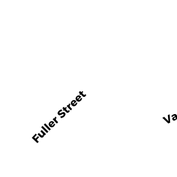
Residential Condominium owned by PAGEL, NICOLE - 72 FULLER ST
Single Family Residential owned by LAVIN CARL D. - 58 FULLER ST
Single Family Residential owned by ZIMMER JOHN C & KATE - 10 WHITFIELD WAY
Single Family Residential owned by CHIN MATTHEW - 66 FULLER ST
Single Family Residential owned by ALBERT KEVIN J & MARY E - 68 FULLER ST
Single Family Residential owned by SHANKS DAVID T & COVITZ JULIE - 70 FULLER ST
Single Family Residential owned by DESHMUKH ANURADHA & NILAY